 Not visible
7TN7 Pca
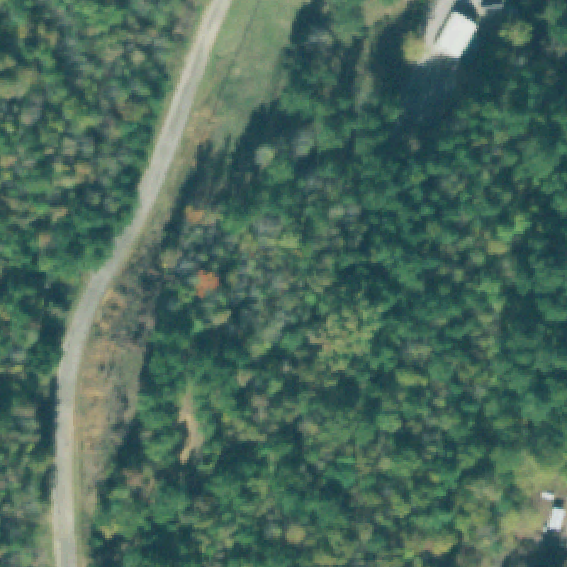
COUNCE, TN
35.0352777780001, -88.2524999999999
Image center is dense forest beside a gravel road; no prepared pad or markings visible.
85% confidence
Verify on the map →
Most U.S. heliports are entered into the FAA record by their owner and never independently inspected. This is an automated first pass that pulls current aerial imagery for each recorded heliport and flags the ones a human should look at - inspired by the AirIndex finding of a long-standing FAA heliport plotted tens of nautical miles from its true location.
Data: FAA Airports (ArcGIS open layer) | Imagery: USGS NAIP (public domain) | built 2026-06-14
A flag means a pad could not be confirmed from current imagery - never that a heliport is missing, fake, or mislocated. Aerial imagery can predate construction, trees and shadows hide pads, and rooftop hospital pads are easy to miss. Every flag is a place for a person to look, nothing more.
Not visibleCOUNCE, TN
35.0352777780001, -88.2524999999999
Image center is dense forest beside a gravel road; no prepared pad or markings visible.
 Not visible
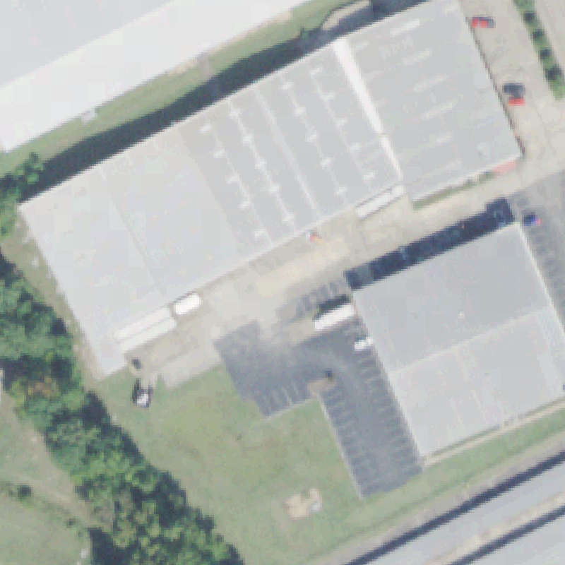
CROSSVILLE, TN
35.9419412780001, -85.019534278
Clear imagery shows a commercial/industrial building and yard at center; no helipad pad or markings visible.
 Uncertain
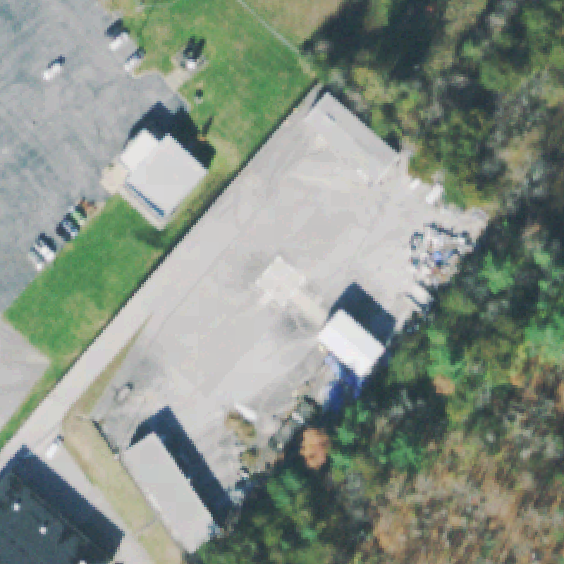
ARLINGTON, TN
35.2886111110001, -89.674166667
Industrial / warehouse complex; a paved lot is visible but no painted H, circle, or touchdown marker at center.
 Uncertain
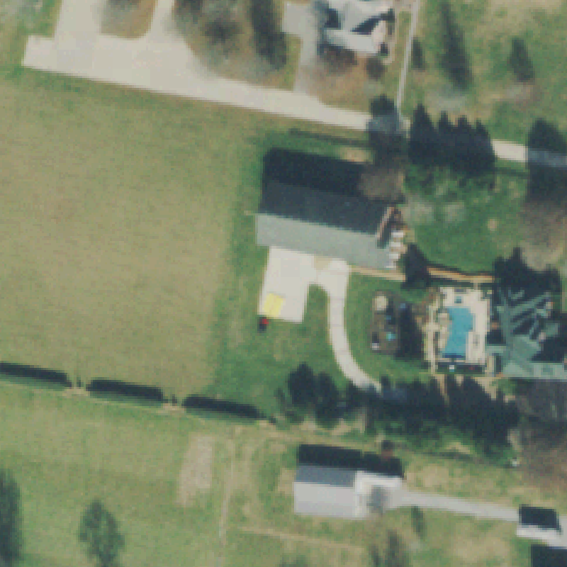
GALLATIN, TN
36.3874888890001, -86.56305
Private property with a pool and outbuildings; a small pad-like square is present but no clear helipad markings.
 Uncertain
HUNTINGDON, TN
36.0221472220001, -88.4123611109999
A small concrete pad sits in the lawn beside the hospital but no helipad markings are resolvable.
 Uncertain
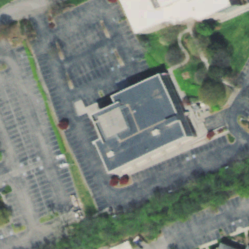
JACKSON, TN
35.637222222, -88.831111111
Large hospital rooftops at center; a rooftop pad is plausible but no marking is clearly resolvable.
 Uncertain
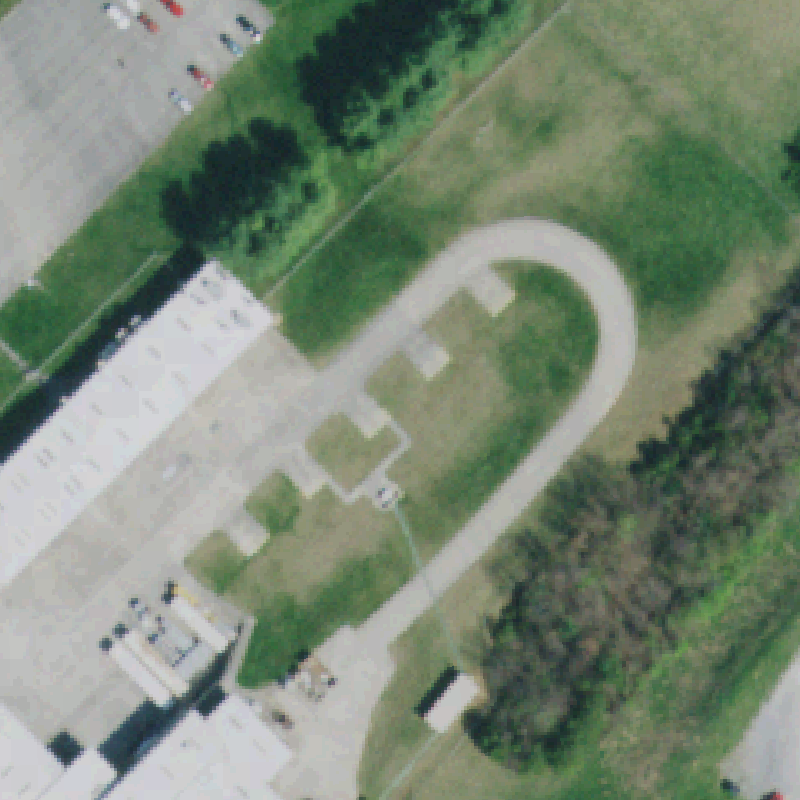
JOHNSON CITY, TN
36.431211111, -82.3076444439999
Unusual teardrop paved loop with small pads at center; no standard helipad marking visible - needs a human.
 Uncertain
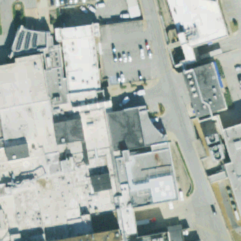
KNOXVILLE, TN
35.9234138890001, -84.090566667
Commercial building rooftop at center; rooftop features are visible but no clear helipad marking.
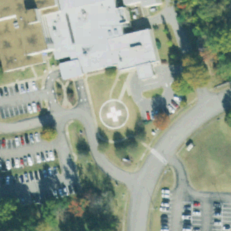
 Confirmed
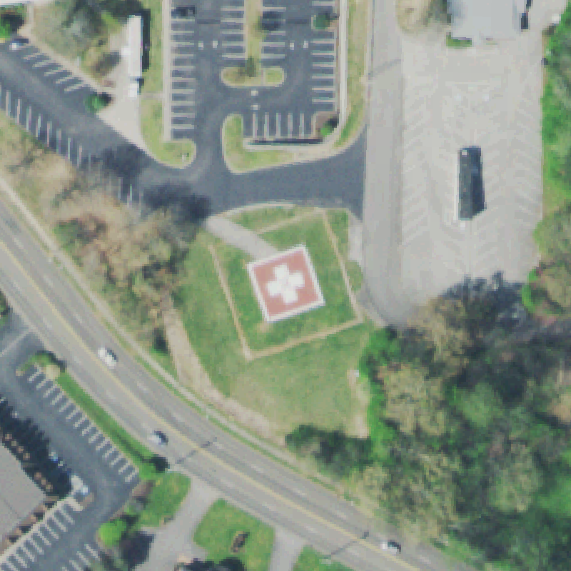
ATHENS, TN
35.439600361, -84.606266333
Red square pad with a white cross clearly visible, centered in the lawn beside the hospital.
 Confirmed
BOLIVAR, TN
35.2681000000001, -88.9991199999999
Light square pad with a cross marking centered beside the medical building.
 Confirmed
BRISTOL, TN
36.5868861110001, -82.2570249999999
Circular pad with a white cross marking clearly visible in the paved area at center.
 Confirmed
CHATTANOOGA, TN
35.042594444, -85.259952778
Red rooftop pad with white markings visible on the hospital roof near center.
 Confirmed
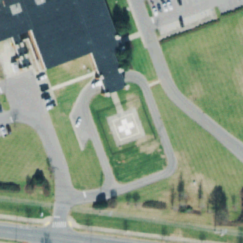
CLARKSVILLE, TN
36.580633333, -87.269388889
Square pad with a white cross centered in the landscaped area beside the hospital.
 Confirmed
CLEVELAND, TN
35.1781750000001, -84.8700916669999
Marked pad with a white cross visible near center in the hospital grounds.
 Confirmed
DICKSON, TN
36.0733888890001, -87.374652778
Square pad with a white cross visible near center, beside the hospital building.
 Confirmed
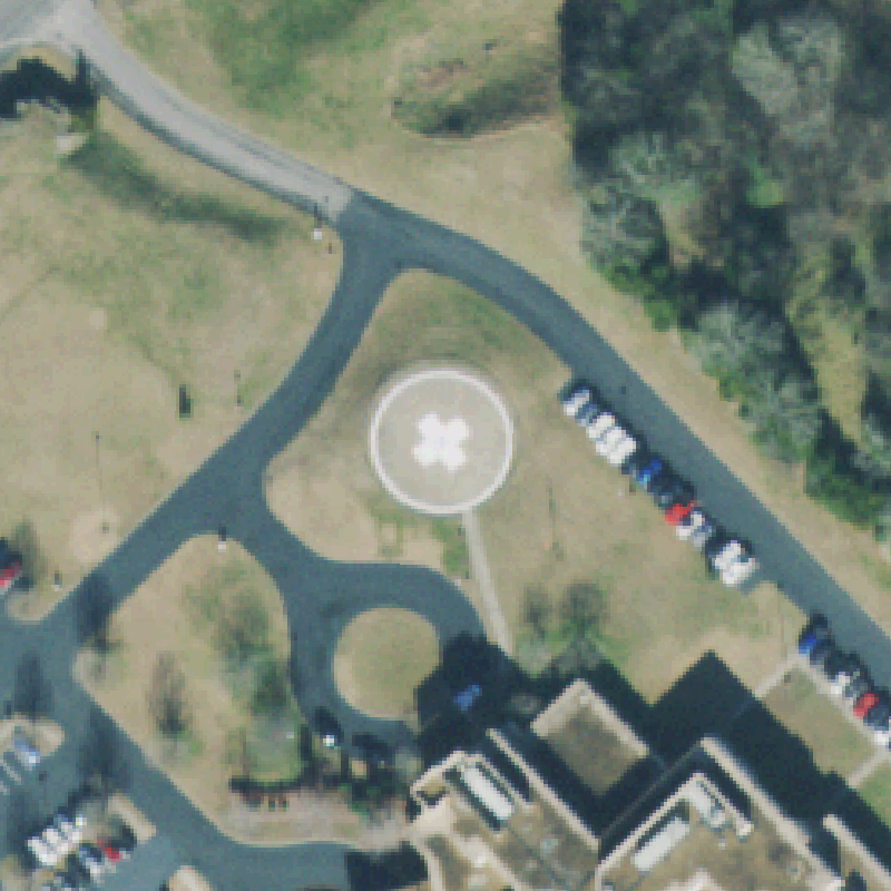
FAYETTEVILLE, TN
35.1503083330001, -86.555561111
Circular helipad with a white cross/H clearly centered in the lawn beside the hospital.
 Confirmed
GERMANTOWN, TN
35.089644444, -89.8073138889999
Light square pad with a white cross visible in the hospital courtyard near center.
 Confirmed
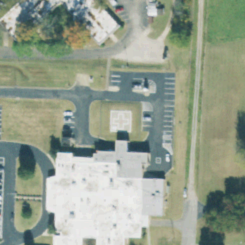
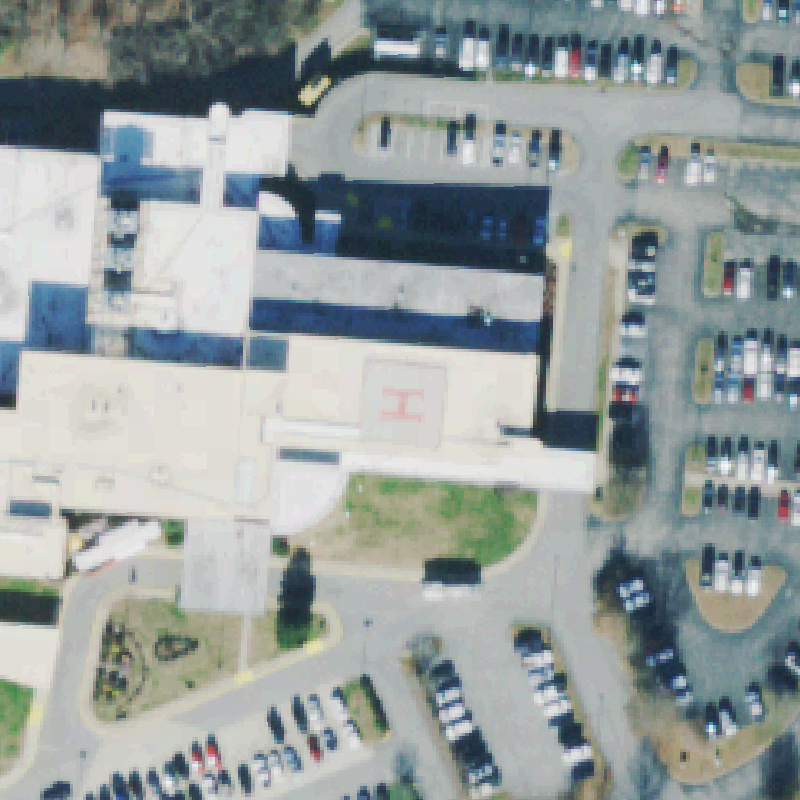
JACKSON, TN
35.683777778, -88.853536111
Circular helipad with a white cross clearly centered near the hospital entrance.
 Confirmed
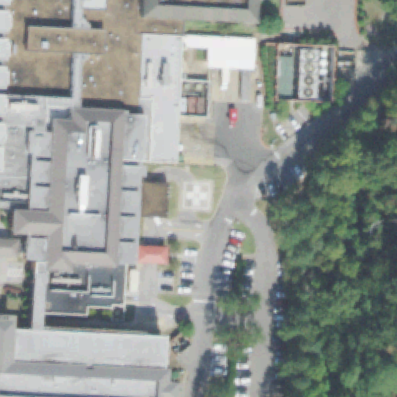
JELLICO, TN
36.573991667, -84.129633333
A prepared square pad with an access walkway sits in the lawn at center, consistent with a ground helipad (no paint resolvable).
 Confirmed
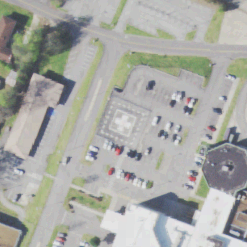
JOHNSON CITY, TN
36.30735, -82.3860083329999
Large marked pad with a white cross visible near center, with a second rooftop H on the medical center.
This is a data-quality research project. Nothing here may be used for flight planning, navigation, or any operational aviation decision. For official, current heliport information, consult the FAA directly.
A flag means a landing area could not be confirmed from a single aerial image at a single moment in time. It is never an assertion that a facility is missing, fake, mislocated, unsafe, or out of compliance. Imagery can predate construction, and trees, shadows, and rooftops routinely hide real pads.
Heliport records are derived from the FAA's publicly available Airports dataset, downloaded from the FAA open-data portal at adds-faa.opendata.arcgis.com. As a work of the U.S. federal government it is open public data; we do not own it and claim no rights in it, and it may contain errors or be out of date. This project is independent and is not affiliated with, endorsed by, or sponsored by the FAA.
The aerial tiles are from the USDA / USGS National Agriculture Imagery Program (NAIP), served via the USGS National Map ImageServer. NAIP imagery is a work of the U.S. federal government and is in the public domain; it may be reproduced freely. Imagery is shown solely to help a human reviewer locate and assess each recorded point, and may be a year or more old. This project is independent and is not affiliated with or endorsed by the USDA, USGS, or the FAA.
Everything here is provided “as is,” without warranty of any kind, express or implied, including accuracy, completeness, or fitness for a particular purpose. Verify independently before relying on anything on this site.
Some recorded heliports sit at private residences or businesses. The locations and imagery shown are already publicly available. If you own a listed facility and would like an entry reviewed or removed, contact us through warmerdigital.com.
FAA, Esri, and all other marks are the property of their respective owners.